
Discover the Tolmie Peak Lookout Trail, a breathtaking hike in Mount Rainier National Park featuring stunning alpine lakes, subalpine meadows, and panoramic views of Mount Rainier. This moderate 5.6-mile round-trip hike offers an unforgettable experience for adventurers seeking scenic beauty and a rewarding summit.
How Difficult Is the Hike to Tolmie Peak Lookout?
Snippet Answer: The Tolmie Peak Lookout hike is moderately challenging, spanning 5.6 miles round trip with an elevation gain of 1,633 feet. The trail includes forest paths, switchbacks, and a steep final ascent, but the breathtaking views of Mount Rainier and Eunice Lake make it well worth the effort.
Discover the Stunning Tolmie Peak Lookout Hike
The Tolmie Peak Lookout Trail in Mount Rainier National Park is one of the most scenic hikes in Washington. This moderate 5.6-mile round-trip trail takes hikers through dense forests, past pristine alpine lakes, and up to an iconic fire lookout, where you’ll experience breathtaking panoramic views of Mount Rainier, the Carbon River Valley, and beyond. The challenging yet rewarding climb to the 5,900-foot summit is a must-do adventure for those seeking stunning landscapes, solitude, and an unforgettable outdoor experience.
Trail Overview
- Distance: 5.6 miles (round trip)
- Elevation Gain: 1,633 feet
- Highest Point: 5,900 feet
- Difficulty: Moderate
- Estimated Time: 2.5 to 4 hours
- Scenic Highlights: Mount Rainier, Eunice Lake, wildflower meadows, panoramic views, historic Tolmie Peak Fire Lookout
- Best Season: July to October (when Mowich Lake Road is open)
Getting to Tolmie Peak Trailhead
The Tolmie Peak Lookout Trailhead is located in the northwest corner of Mount Rainier National Park, near Mowich Lake. To reach the trailhead:
- Drive SR165 to Mowich Lake Road, which is a 17-mile gravel road. It can be rough and full of potholes, so a high-clearance vehicle is recommended.
- The trailhead is near Mowich Lake Campground, with limited parking spots available. Arrive early in the morning to secure parking.
- Restrooms and a self-pay station are available near the parking area.
For more incredible hiking adventures, check out 15 Must-See Wonders in Death Valley National Park for Your Bucket List!.
Hiking to Tolmie Peak Lookout
The trail begins at Mowich Lake, following the Wonderland Trail for the first 1.5 miles. This section is relatively easy, winding through lush old-growth forests and offering occasional glimpses of Mount Rainier through the trees.
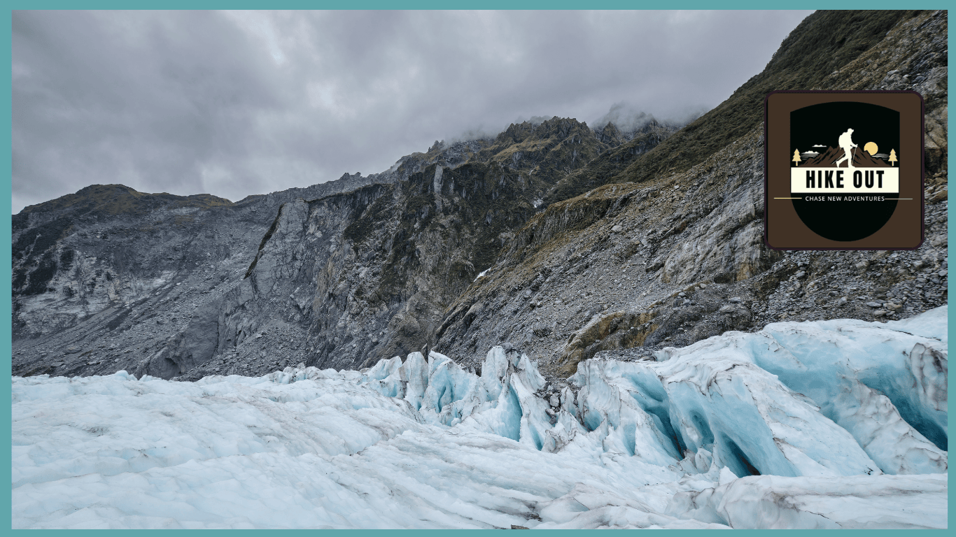
{“Step into the icy wonderland of Mount Rainier’s glaciers. HikeOut Adventures brings you the most stunning frozen landscapes in the Pacific Northwest!”}
Stop at Eunice Lake
At 1.8 miles, the trail reaches Eunice Lake, a pristine, sapphire-blue alpine lake surrounded by subalpine meadows. This is a perfect place to take a break, enjoy the scenery, and refuel before the final ascent to Tolmie Peak.
Final Climb to the Lookout
From Eunice Lake, the last mile is the most challenging, featuring steep switchbacks and an exposed ridgeline. However, as you gain elevation, the views open up, revealing Mount Rainier towering over the surrounding peaks. At the summit, you’ll find the historic Tolmie Peak Fire Lookout, built in 1933 by the Civilian Conservation Corps.
Best Time to Visit
The best time to hike the Tolmie Peak Lookout Trail is mid-July to October when Mowich Lake Road is open and the trail is snow-free.
- Summer (July–August): Wildflowers bloom, creating a colorful landscape around Eunice Lake.
- Fall (September–October): Experience stunning fall foliage and crisp, clear air, making for some of the best photography conditions.
- Winter & Spring: The road to Mowich Lake is closed, making access nearly impossible unless you’re prepared for a long snowshoeing trek.
Essential Hiking Tips
✔ Start early to secure parking and enjoy quieter trails.
✔ Pack bug spray, as mosquitoes are common near Eunice Lake.
✔ Wear proper hiking boots for the rocky, steep ascent.
✔ Bring plenty of water and snacks, as there are no facilities along the trail.
✔ Check weather conditions, as fog can limit visibility at the summit.
✔ Be prepared for high-altitude weather changes, as conditions can shift rapidly.
✔ Respect Leave No Trace principles, ensuring the trail remains beautiful for future hikers.
For more thrilling adventures, don’t miss Uncover the Ultimate Titus Canyon Road: Death Valley’s Most Stunning Drive!.
Scenic Highlights
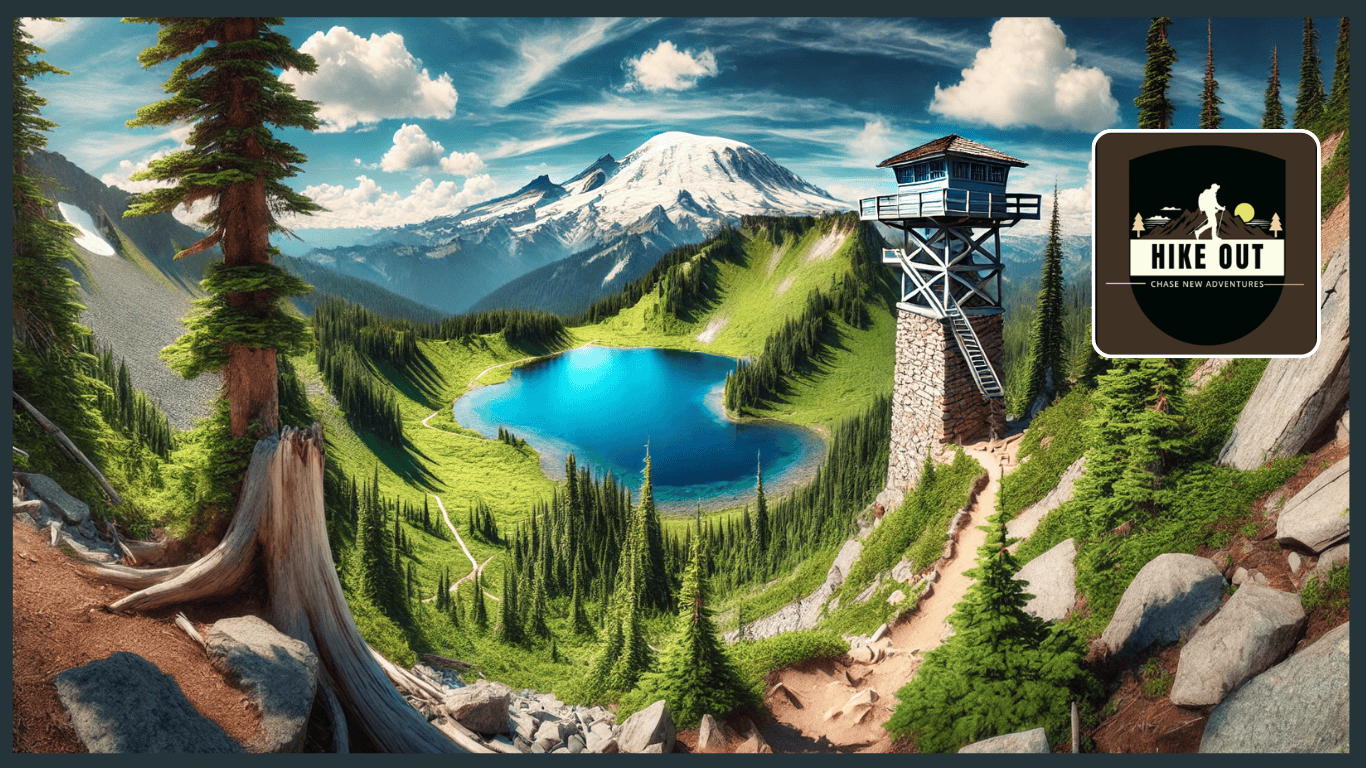
{“Discover the spectacular Tolmie Peak Lookout, where Mount Rainier towers over the shimmering Eunice Lake. A must-visit for every hiking enthusiast!”}
- Eunice Lake – A pristine alpine lake reflecting the surrounding peaks.
- Tolmie Peak Lookout – A historic fire tower with incredible views of Mount Rainier.
- Wildflower Meadows – Mid-summer blooms create a colorful landscape.
- Glacier Views – Panoramic sights of Rainier’s glaciers and rugged terrain.
- Sunrise & Sunset Views – The lookout provides stunning golden-hour photography.
- Wildlife Sightings – Spot deer, marmots, and birds of prey along the way.
Trail Safety & Regulations
- No pets allowed to protect wildlife and fragile ecosystems.
- Fires are prohibited in the park.
- Follow Leave No Trace principles – Pack out all trash.
- Check the National Park Service website for trail and road updates.
- Be aware of bears – Store food properly and carry bear spray as a precaution.
- Cell service is limited – Download maps in advance or carry a GPS device.
♦Ultimate Tolmie Peak Lookout Trail Q&A: Insider Insights & Expert Tips♦
Is Tolmie Peak inside Mount Rainier National Park?
Yes, Tolmie Peak is nestled within the northwest region of Mount Rainier National Park, near Mowich Lake. This 5,920-foot (1,800-meter) peak offers stunning panoramic views of Mount Rainier, Eunice Lake, and the surrounding Cascade Range.
Which is the most popular hiking trail in Mount Rainier National Park?
While Tolmie Peak Lookout is a must-visit gem, the Skyline Loop Trail remains the most sought-after hike in Mount Rainier National Park. This 5.7-mile trail from Paradise boasts a 4.9-star rating on AllTrails, featuring breathtaking landscapes, waterfalls, and spectacular Mount Rainier views.
What is the most challenging hike on Mount Rainier?
The Camp Muir Trail ranks as the most strenuous day hike in Mount Rainier National Park. Spanning 9 miles round-trip, this trail gains a staggering 4,788 feet in elevation, reaching 10,188 feet. It demands technical skills, endurance, and glacier-travel experience.
Which entrance is best for accessing Mount Rainier National Park?
Mount Rainier offers four main entrances, each catering to different areas:
- Nisqually Entrance (Southwest) – Most frequented, accessible year-round
- Carbon River Entrance (Northwest) – Closest to Tolmie Peak, but Mowich Lake Road is rugged and seasonal
- White River/Sunrise Entrance (Northeast) – Leads to Sunrise, the highest drivable point in the park
- Stevens Canyon Entrance (Southeast) – Ideal for a scenic drive with waterfall views, connecting to Paradise
Can you hike to the summit of Mount Rainier?
Yes, but reaching Mount Rainier’s peak is a formidable challenge. The climb entails a 9,000-foot elevation gain, covering over ten miles of technical glacier trekking. Climbers must be well-trained, physically fit, and experienced in rope skills and crevasse navigation.
How long is the Poo Poo Point Trail?
Located near Issaquah, Washington, the Poo Poo Point Trail spans 6.6 miles round trip. Rated moderately challenging, the trail ascends 1,850 feet and typically takes around 3 hours and 47 minutes to complete.
What is the easiest route to climb Mount Rainier?
The Disappointment Cleaver/Ingraham Glacier Route is considered the most accessible path to the summit. However, it still requires technical glacier skills, team coordination, and proper gear. Climbers usually camp at Camp Muir before pushing to the summit.
Which areas of Mount Rainier National Park should I not miss?
Top destinations within Mount Rainier National Park include:
- Paradise – Famous for lush wildflower meadows and the Skyline Trail
- Sunrise – Offers panoramic vistas from the park’s highest driveable point
- Grove of the Patriarchs – Features massive old-growth trees along a scenic boardwalk
- Silver Falls Trail – A serene waterfall hike with forested pathways
- Skyline Trail – One of the most iconic hikes in the park
- Longmire – A historic area featuring visitor centers and picturesque trails
Where are the best spots to photograph Mount Rainier?
Some of the top photography locations include:
- Paradise Area – Captures wildflower meadows with Mount Rainier as a backdrop
- Tipsoo Lake – Known for reflective sunrise and sunset shots
- Reflection Lakes – One of the most famous mirror-image spots of Mount Rainier
- Sunrise Area – Offers sweeping mountain views with fewer crowds
Is Mount Rainier climbable for beginners?
While beginners can attempt Mount Rainier with proper training, it demands months of preparation. The Disappointment Cleaver Route is the best choice for beginners, but it still requires strong fitness, endurance, and technical glacier-travel skills.
Is hiking around Mount Rainier safe?
Yes, but hikers must stay prepared. Mount Rainier’s weather is unpredictable, and sudden changes can increase risks of hypothermia, getting lost, or encountering hazardous conditions. Always carry proper gear, check forecasts, and follow National Park safety protocols.
What is the toughest hike in the world?
One of the most extreme hikes worldwide is the Great Himalaya Trail, spanning thousands of miles across Nepal. It takes months to complete, traversing high-altitude passes, remote villages, and harsh weather conditions.
What is the best time of year to visit Mount Rainier National Park?
The prime months to visit are July and August, when trails are snow-free, wildflowers are in bloom, and weather conditions are favorable. Since these months attract high visitor traffic, it’s best to start early in the day to avoid crowds.
Which visitor center is best for exploring Mount Rainier?
The Jackson Visitor Center at Paradise is the largest and most informative, featuring interactive exhibits, a park film, a gift shop, WiFi, and seasonal ranger programs. Other notable centers include Sunrise and Longmire.
Essential Hiking Resources & Pro Tips
Planning a trip to Tolmie Peak Lookout or exploring Mount Rainier National Park? Stay ahead with these official resources and expert-approved hiking guides for real-time trail updates, safety tips, and must-know information:
🌲 Official Park Info: National Park Service – Mount Rainier – Get up-to-date details on park regulations, seasonal road closures, and essential permits.
🥾 Trail Reports & Reviews: Washington Trails Association – Tolmie Peak Lookout – Read recent trip reports, discover trail conditions, and get insights from experienced hikers.
📍 Interactive Maps & GPS Routes: AllTrails – Tolmie Peak Lookout Trail – Explore route maps, elevation profiles, and user-generated tips to plan your perfect hike.
Final Thoughts
Whether you’re setting out for Tolmie Peak Lookout, tackling a challenging Rainier summit, or exploring scenic trails, this guide provides essential answers for a well-planned adventure. Stay informed, be prepared, and immerse yourself in the unmatched beauty of Mount Rainier National Park!
1 thought on “Breathtaking Views: Tolmie Peak Lookout Hike Guide”